There is a new spectral library in town! Nearview has released its beta web app https://speclib.nearview.net . This open-access library is currently focused on macroalgae (aka, seaweed) and intertidal resources in the northeast US. The library is now open for browsing, registration, data contributions, and downloads. Climate change, sea level rise, coastal development, and fishing/harvesting […]
Category: Uncategorized
NOAA SBIR Program Awards Nearview Phase 2 R&D Grant
Nearview is pleased to announce that it has been awarded a Phase 2 R&D grant from the NOAA Small Business Innovation Research (SBIR) program! We are excited to be working with an amazing group of scientists and research organizations to build digital spectral libraries and geo-platforms that map intertidal and coastal zone resources. We will […]
Nearview awarded NOAA SBIR Phase I grant
Nearview is a leader in aerial drone remote sensing and analysis of the coastal environment. We are proud to announce that we have been selected as a NOAA SBIR Phase I grant recipient to develop an “AI Model for Automated Detection and Mapping of Intertidal Vegetation.” We are leveraging drone technology and computer-aided learning to […]
Industrial Inspection of Sea-3 Facility in Newington, NH
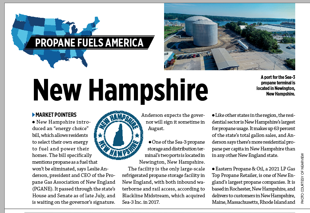
Nearview conducts mostly aerial drone environmental applications, but occassionally we get the call to collect imagery and inspect industrial facilities and infrastructure. One of our images was recently featured in an issue of LP Gas Magazine: https://editions.mydigitalpublication.com/publication/?i=686300&ver=html5&p=21. We are pleased to survey industrial assets – we have the technology, safety record, and skillset to collect […]
Make Better Decisions with Nearview
Can you imagine a natural or cultural resources field project today without a GPS? Similarly, at Nearview we envision and realize a future where drones will be a necessary tool for every environmental science field project. Our surveys are highly accurate and packed with valuable data thanks to sophisticated multi- and hyperspectral sensors deployed on […]
3D Modeling of Buildings for Insurance Claims and Historic Preservation
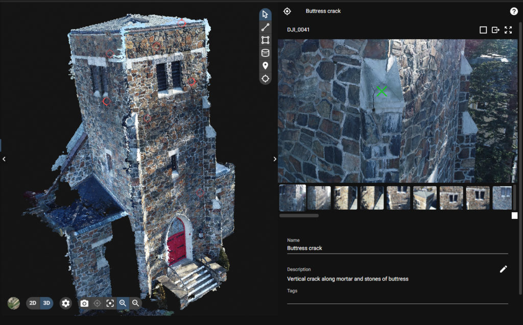
#Nearview uses #drone tech to support the #insuranceclaim as well as #historicpreservation industries by providing #3dmodeling of buildings with tagged high-resolution images to highlight and identify damage and areas of concern. This is a particularly useful approach for buildings and structures that are difficult to access, and provides clients with easy cloud access to explore […]
2020 Wild & Scenic Film Festival
Nearview is proud to be a sponsor of this year’s Wild & Scenic Film Festival showing at the Red River Theatres in Concord, NH on Friday, March 27, 2020 (https://nhrivers.org/film-festival-2020/). This sold-out event is hosted by the New Hampshire Rivers Council @NewHampshireRiversCouncil, #nhriversfilmfestival. Contact the NH Rivers Council to get on the wait list, and […]
No Planet B!
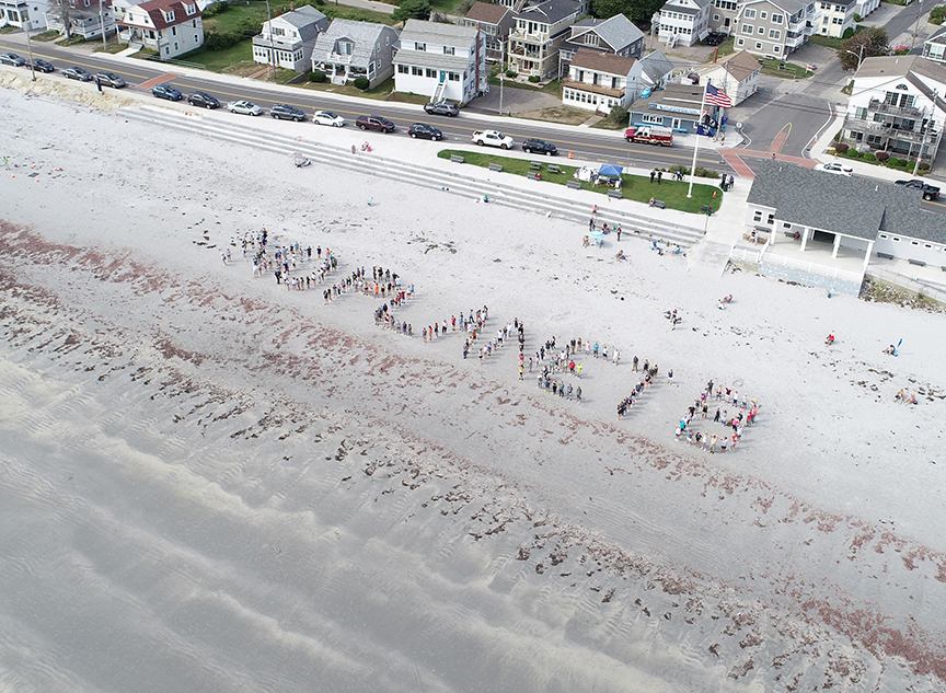
Today we were thrilled to photo the entire eighth grade class from York Middle School on Long Sands Beach in York, Maine. Following a morning of beach cleanup these activist kids organized to form a human sign and express their concern over pollution, environmental changes and sea level rise. Thank you for inspiring us adults, […]
Eelgrass Survey Captures Image of Schooling Fish in Penobscot Bay, Maine
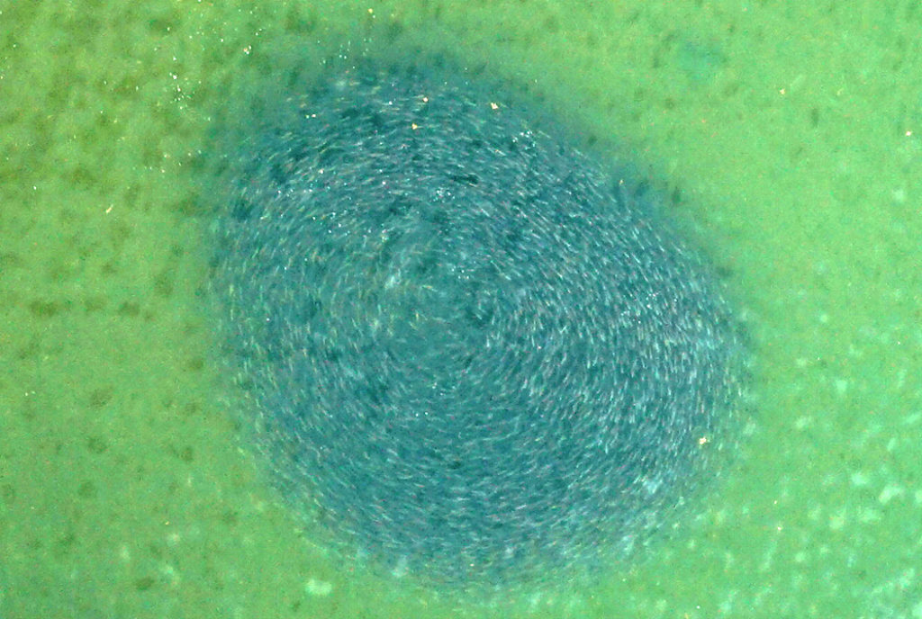
Nearview conducted #eelgrass surveys in Penobscot Bay this past week for the Maine DEP. During UAS survey we coincidentally imaged nature in action – an impressive tornado of hundreds of schooling fish in shallow water. We are uncertain of species, but possibly #atlanticherring #alewives or #menhaden. Unfortunately, nearly all the areas we surveyed, which were […]
Mapping Historic Cemeteries with Drones
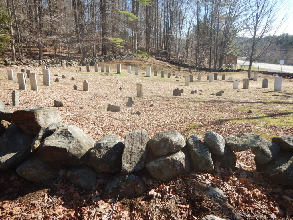
Nearview is mapping several historic 1800s cemeteries for the town of Bristol, NH. We are using drones to build high resolution models of existing conditions, and developing a GIS of burials and monuments. With this information Bristol can identify and manage vegetation encroachment and erosion, identify stone walls and monuments in need of repair, and […]