NOAA SBIR Program Awards Nearview Phase 2 R&D Grant
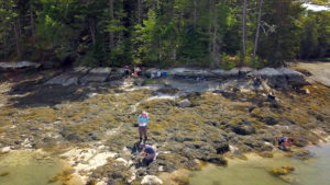
Nearview is pleased to announce that it has been awarded a Phase 2 R&D grant from the NOAA Small Business Innovation Research (SBIR) program! We are excited to be working with an amazing group of scientists and research organizations to build digital spectral libraries and geo-platforms that map intertidal and coastal zone resources. We will build on our Phase 1 R&D work using drone and satellite imagery as well as machine learning to map intertidal vegetation such as macroalgae at multiple geographic scales. Our goal is to provide both public and private stakeholders (e.g., resource managers, seaweed harvesters, aquaculture industries, policy makers, municipalities, and NGOs) tools for monitoring the health of intertidal resources and making informed decisions. Stay tuned at #nearviewllc – much more to come as the project gets underway.