Nearview’s first year of operations and bright future for aerial drone environmental applications
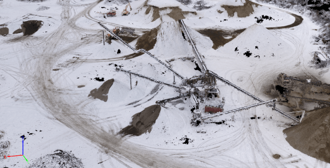 3D point cloud of gravel crusher and sorter.
2017 was an exciting year for Nearview. We hit many firsts including photogrammetric mapping of a 200+ acre gravel and sand mine in freezing wintry conditions, documenting wetland restoration progress at a Superfund Site, and our first large-scale multispectral vegetation survey that processed over 25,000 images. We’ve successfully supported clients by providing accurate and high-resolution map products at low cost and with rapid turnaround. We are already gearing up for a busy 2018, and in the planning stages of a multi-year beach erosion study along the northern New England coast, mapping invasive species and eelgrass for conservation and land trusts, and providing aerial documentation and mapping services for environmental justice groups. Nearview has the experience and expertise to help you safely launch drone operations, all the while respecting privacy, and mitigating cost and risk. This year we plan to scale-up operations, bring on staff, and expand our hardware, software, and technological capabilities. We look forward to talking and working with you in 2018. Drones for Good!