Nearview Completes Fall Season Beach Surveys for the Maine Coastal Program
 Beach survey with surveyor taking well-deserved break after fat-biking miles of beach to set aerial targets.
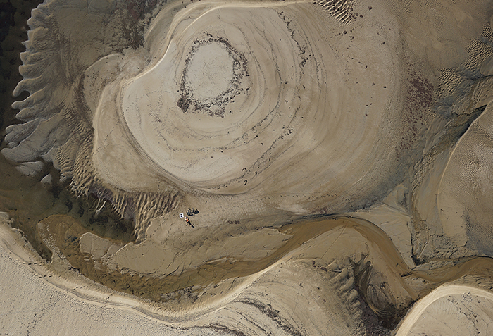
Amazing what landscapes can form in sand with a little water. A closer look reveals one of our surveyors taking a well-deserved break after fat-biking miles of beach to set aerial targets. Nearview successfully completed its Fall season of beach surveys for the Maine Coastal Program. With surveys underway since 2018, we are now able to document seasonal and annual beach and nearshore changes as well as measure sand volumes. Nearview has developed cost-effective and accurate aerial survey methods that can be used by communities and organizations seeking to monitor beach erosion, shoreline change, and sediment movement. We are ready to partner and provide the data you need to understand coastal change, support beach re-nourishment, and build resilience. Get in touch! #beacherosion #beachnourishment #UAS #dronesforgood #coastalresiliency #coastalchange